 |
CalbourneIsle of Wight |
Old postcards are sometimes poorly produced and grainy, I've done my best to scan them. Please click thumbnails for full size picture. Dates are from the card or my estimate (where possible).
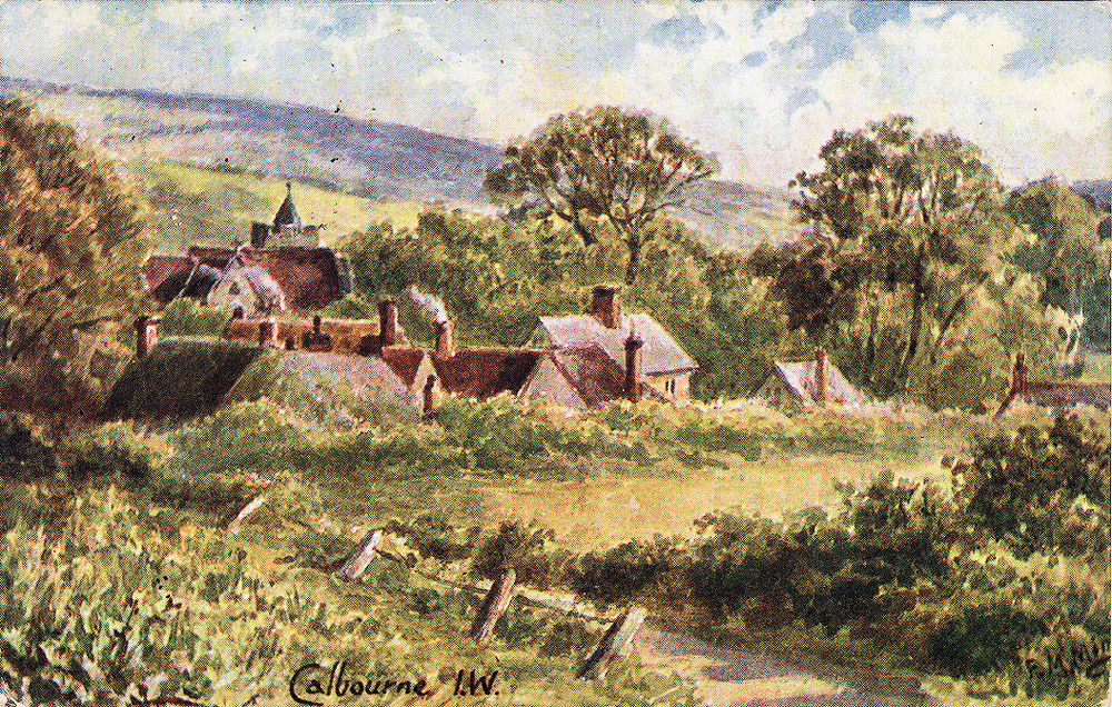
A Watercolour by F.M. Minns of Calbourne from a card postmarked 1907. The back of the card includes an extract from 'The Silence of Dean Maitland' written by Maxwell Gray and published in about 1886, which was set in area based in Calbourne:
'The village nestled under the down, the sweeping grounds of Northover on on side'
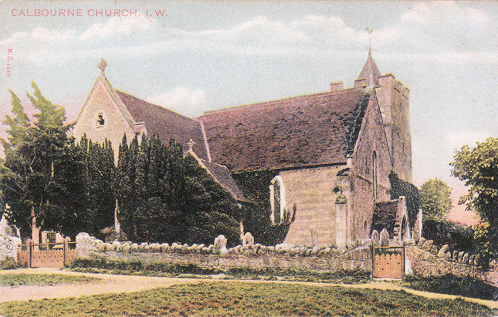
Calbourne is a small village on the road between Freshwater and Newport. It is mainly known for 'Winkle Street', a picturesque lane with a stream running alongside. There is a church of which the origin is not entirely clear, but it is known that the land was granted by King Egbert in A.D.826 and it is thought that a church was built soon after. The current church was built in the 13th century, although it has been modified on several occasions since.
The name Calbourne is derived from the stream rising on the downs above the village and running through Newbridge and Shalfleet into the Solent at Newtown. The village was originally known as Cawelburn. The name is said to arise from cawel being the old name for kale and burn meaning stream.
|
|
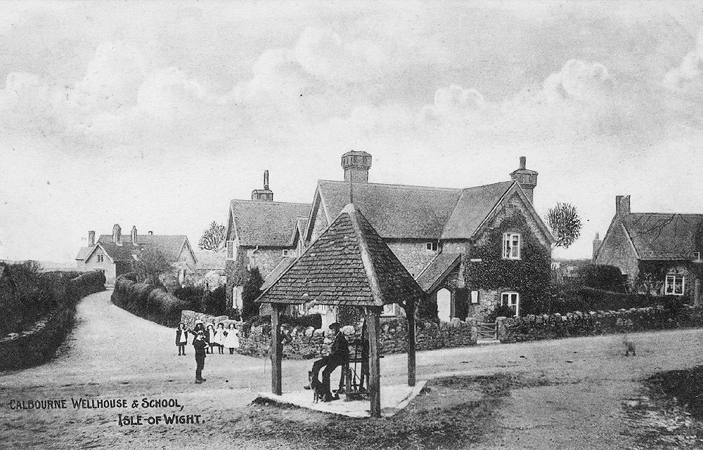
The Well and School House, Calbourne about 1911. (Millman) |
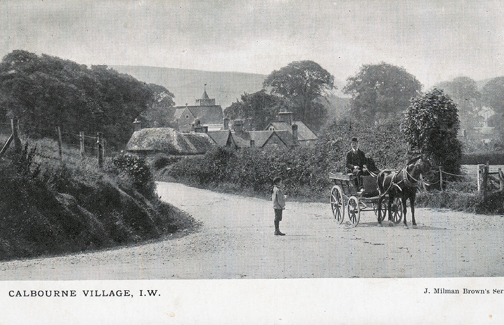
The crossroad near the Sun Inn. The church may be seen in the middle distance. Undated, but around 1910. (Millman) |
|
|
A undated card of Calbourne Church, probably around 1910 (Peacock) |
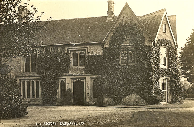
An undated, and unattributed, card of Calbourne Rectory. This building is now in private hands. |
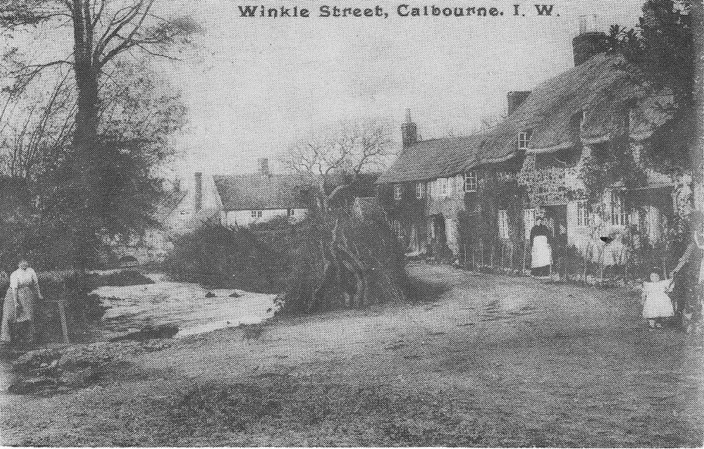
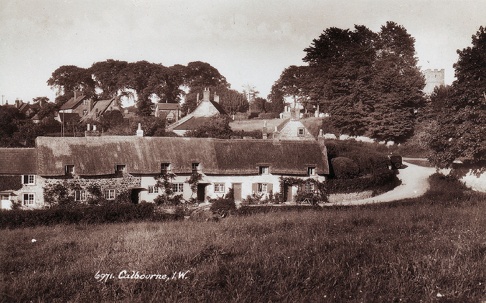
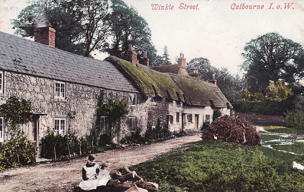
Calbourne is best known for Winkle Street, a tourist attraction which seems to have come to prominence in the 1920's with the advent of improved transport. The actual name of the road is Barrington Row, which is named after the owners (until 1832) of the Swainston Estate (to the east of Calbourne). The origin of the name is not really known, suggestions include that it was named after John Winkle, rector of Shalfleet 1339 - 1347, that the name winkle meant a lane that turns a corner an leads nowhere, that the english word winkle meant to twinkle, or that it was where empty winkle shells were deposited, having been collected from Newtown Creek. Take your choice!
The following description was taken from a publication 'This Garden Isle' by Peter Norris, probably from the 1930's:
'Winkle Street, a row of little cottages looks out across a rough stone lane to a stream babbling between grassy banks where wild flowers bloom in abundance. All about the cottage walls are beautiful flowering creepers, and in front of each window is a plot of flowers so carefully tended and loved. No wonder what the season, there are always some blossoms here. In June and July, they bloom in violent and riotous confusion, within sound of the happy chattering water. Despite the advent of charabancs and trippers, this piece of Calbourne still retains its air of peace and seclusion.'
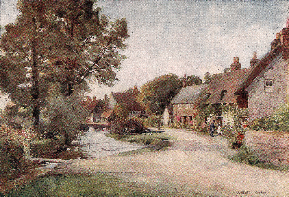
An artistic watercolour view of Winkle Street by A. Heaton Cooper, certainly before 1916.
|
 |
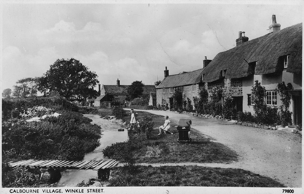
View of Calbourne Village, Winkle Street in the foreground with the Church top right. (Sweetman) |
An early but undated view of Winkle Street. It was customary for residents to stack their bundles of wood (faggots) by the stream. |
|
|
Another undated view of the Winkle Street this time from the opposite direction. |
A later, but again undated view of Winkle Street. (Photochrom) |
|
|
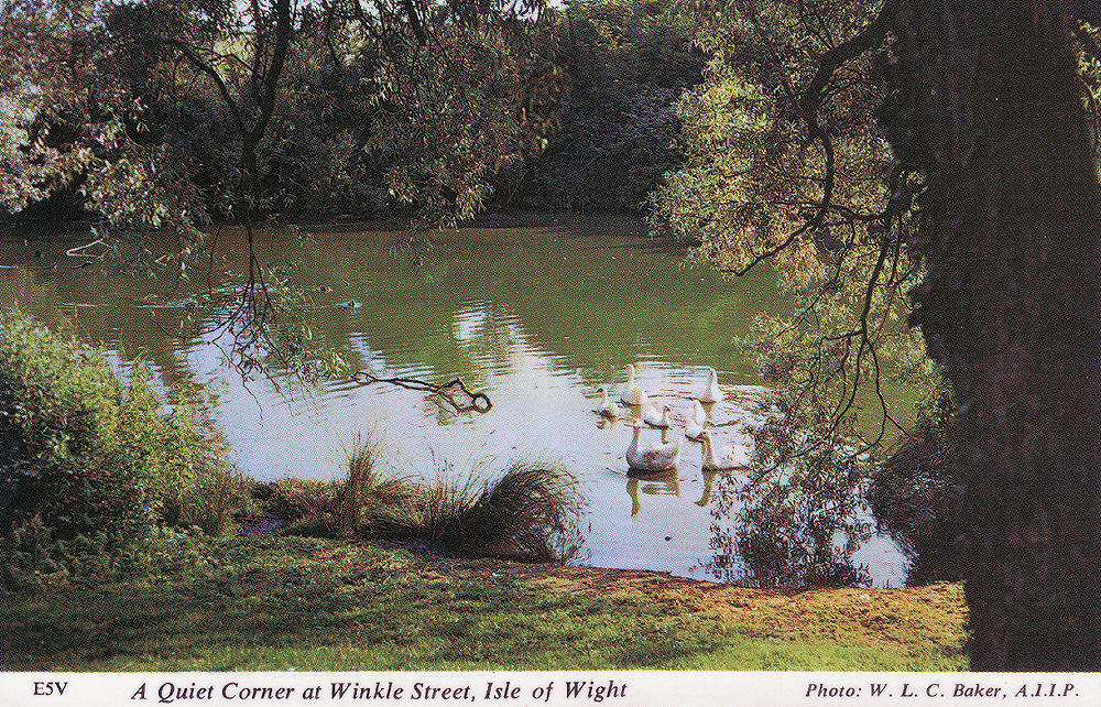
Described as 'A quiet Corner on Winkle Street', this probably shows the pond just inside the gatehouse of Westover Manor (Collis) |
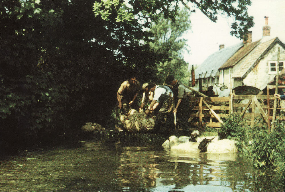
Sheep dipping took place in the stream, this card shows the last occasion in 1976. (Graham) |
|
|
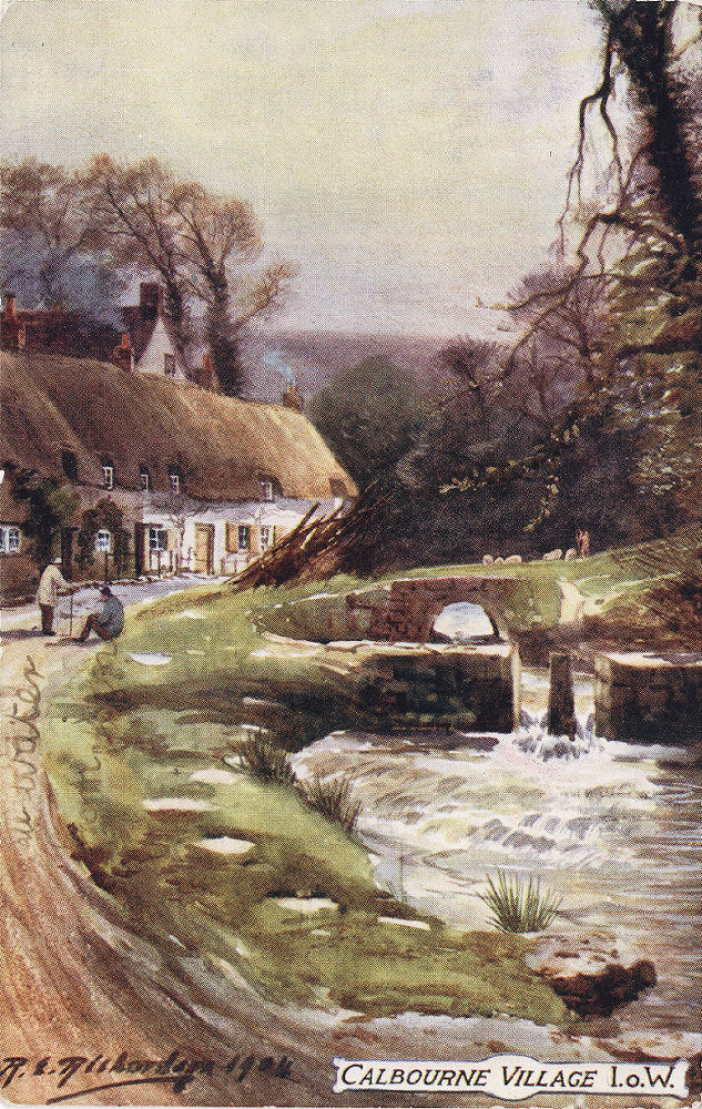
A artistic impression of Winkle Street dated 1904, although not referred to as such. the area used as a sheep dip is in the foreground. (Tuck) |
|
Calbourne one had three water mills, the nearest to the village on the Freshwater road was Fulling Mill (which was used to process cloth and run by monks), slightly further on was Upper Mill (see below) and slightly further on was Lower Mill, which is near Newbridge. Upper Mill is now known as Calbourne Mill and open to the public
|
|
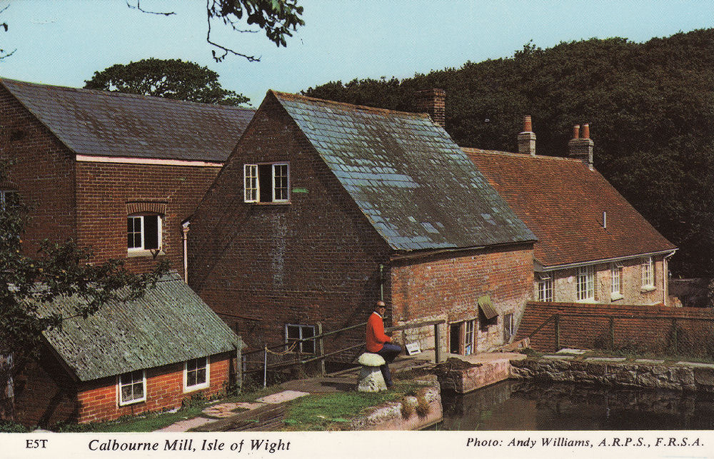
A modern view of the mill showing the mill pond and original mill buildings on the left. (Collis) |
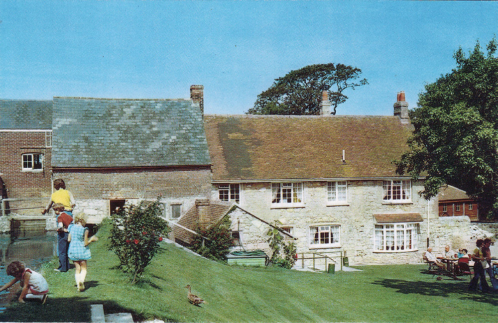
Another view of the Mill, about 1980. (Nigh) |
 |
 |
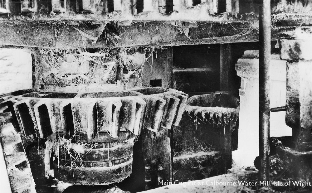
An undated card of the cog pit before restoration at Calbourne Mill, complete with cobwebs! |
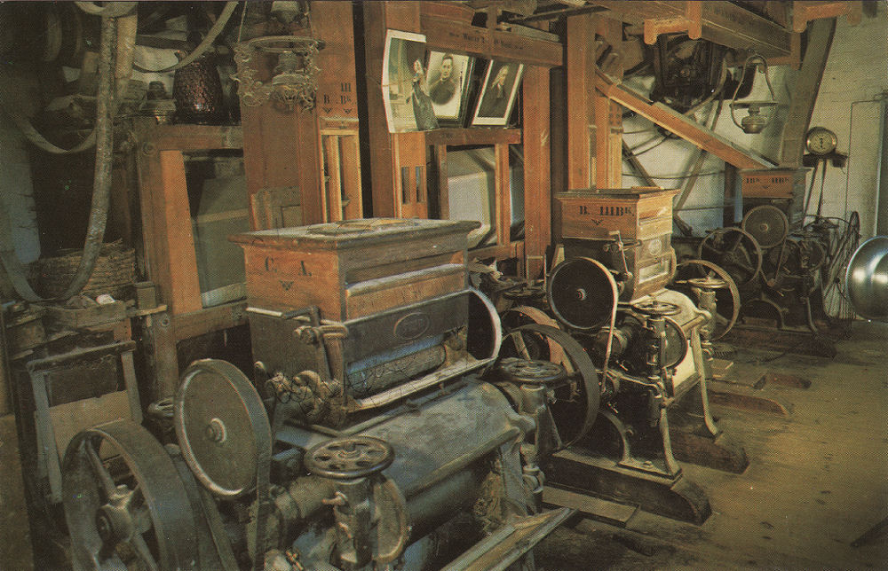
Restored machinery at Calbourne Mill. (Nigh) |
|
|
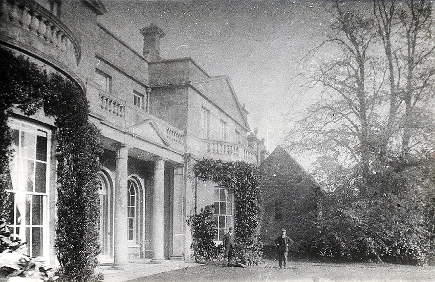
An unidentified and undated card of Swainston House, (to the east of Calbourne) with the chapel to the right. |
25 April 2020